

Q: Where does Paul Bunyan Communications (PBC) get the flight data?
A: An antenna on one of our towers receives the ADS-B messages directly from the aircraft.
Q: Do we hide flights or modify the data we receive?
A: No, the map displayed on the channel shows the information exactly as we receive it.
Q: Why don’t I see a specific flight, or why are only airplanes above a certain altitude visible?
A: Our receiver has detected ADS-B messages from aircraft up to 500 miles away, but the messages can only be received if the source aircraft is “line of sight” with our antenna. Because of this, transmissions from aircraft that are very far away will only be received if they are at a high altitude and not occluded by ground obstructions like terrain and trees.
Q: What is the audio feed?
A: The audio is received over the air by a radio monitoring two VHF frequencies, the Bemidji Common Traffic Advisory Frequency (CTAF) and Minneapolis Center (Sector 25 Low/High). CTAF is typically used for air-to-air communication between aircraft, and the Minneapolis Center channel is used to communicate with air traffic controllers.
Q: Why can I only hear one side of a conversation?
A: Due to the location of the two speaking parties relative to our receiving antenna, we may have been unable to receive the signals from one of the transmitters, or the received signal was too weak.
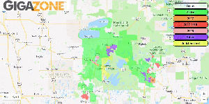
Q: Why are the aircraft different colors?
A: The color indicates the approximate altitude of the aircraft measured in feet above Mean Sea Level (MSL). If an aircraft is grey, its transmitter is in ground mode. The legend on the bottom of the screen indicates the approximate altitude.
Q: I saw an aircraft that was only a hundred feet above my head, why does it show the altitude was over 1,500 feet?
A: See question above. The altitude is reported in feet above Mean Sea Level (MSL). For example, Lake Bemidji is approximately 1,342 feet above MSL. If you were on lake Bemidji and a plane flew 150 feet above you, it would be at approximately1,500 feet above MSL.
Q: What are the text/numbers on the left side of the screen?
A: These are Meteorological Aerodrome Reports (METARs) for local airports. KBJI is Bemidji Regional Airport, KDLH is Duluth International Airport, and KHIB is Range Regional Airport in Hibbing. A detailed guide on how to read METARs can be found at https://www.flightradar24.com/blog/how-to-read-metar-weather-reports/
Q: What are the letters/numbers to the right of the date and time and/or last updated time for the METARs?
A: This is a timestamp in METAR format, showing the day of the month and UTC time. e.g. 071830Z would be the 7th of the month at 6:30pm UTC. Which is 12:30PM in our time zone when we are on standard time or 1:30PM when we are on Daylight Savings Time.
Q: What do the letters and numbers next to the aircraft mean?
A: These are typically either an airline code followed by a flight number or aircraft tail number. Tail numbers for US registered aircraft begin with the letter “N”. Canadian registered aircraft begin with “C” (or VO for Newfoundland aircraft registered prior to 1949).
Airline codes and radio call signs can be found here: https://www.faa.gov/air_traffic/publications/atpubs/cnt_html/chap3_section_3.html or https://en.wikipedia.org/wiki/Airline_codes
Aircraft tail numbers for US registered Aircraft can be found here: https://registry.faa.gov/aircraftinquiry/Search/NNumberInquiry
Aircraft tail numbers for Canadian registered aircraft can be found here: https://wwwapps.tc.gc.ca/Saf-Sec-Sur/2/CCARCS-RIACC/RchSimp.aspx
A listing of tail number prefixes can be found here: https://en.wikipedia.org/wiki/List_of_aircraft_registration_prefixes